


All week long on Alabama Public Radio, we’ve been looking back at the tornado outbreak on April 27, 2011. The storms impacted homeowners and businesses, and you’ve heard from many of them during our coverage.
Now we’ll look ahead. For the past two months, dozens of scientists have been conducting groundbreaking research on tornadoes and severe weather right here in Alabama.
APR’s Alex AuBuchon has more on the impact that research could have on meteorologists' understanding of severe weather and forecasters’ ability to predict it.
During severe weather, most people get their forecasts and weather information from TV meteorologists like ABC 33/40’s James Spann. But those forecasts start far earlier.
It’s a beautiful spring day in Huntsville now. But a group of forecasters and other scientists are laser focused on what’s coming tomorrow. All their models suggest severe weather on the horizon and the potential for strong tornadoes. The National Weather Service forecasters and emergency managers seem concerned, but other scientists seem almost hopeful. Or maybe “hopeful” isn’t the right word.
“It's kind of a fortunately / unfortunately question. We certainly don't want to see the destruction, but we do need the storms in order to conduct our research.”
Tony Lyza is a Ph.D candidate at the University of Alabama at Huntsville and one of the main researchers in VORTEX-SE, a massive study examining severe weather and how tornadoes form specifically in the southeastern U.S.

VORTEX-SE stands for the Verification of Origin of Rotation in Tornadoes Experiment Southeast, which is why we’ll just call it VORTEX from now on.
Heading the project is Dr. Erik Rasmussen. He designed this study from the ground up, and led two previous VORTEX research projects in Oklahoma in the mid-90s and late-2000s. Rasmussen says when the funding for VORTEX-SE was announced, there was some controversy. Lots of scientists say tornadoes are tornadoes, no matter where they occur.
“And, in fact, tornadoes probably pretty much are tornadoes. But how a thunderstorm causes a tornado and supports a tornado – those things vary radically from one part of the country to the other. In the plains, they’re done by supercells, these big, long, live rotating storms. In the southeast, they seem to spring up a lot more quickly from storms that are a lot less well-defined.”
And so the researchers came to Alabama. Rasmussen says he had hoped to design this experiment based off his previous two VORTEX campaigns in Oklahoma, but that plan got scrapped.
“VORTEX in the plains relies on a dense road network, flat roads, no trees, no hills, storms that you can see coming for 30 or 40 miles, and so the science you can do out in the plains is completely different than what’s possible to do in the Southeast. So we’ve had to pretty much redesign the whole concept.”
For one thing, storm chasing isn’t an option.
“We can’t chase storms in the Southeast because of blockage by trees.”
Dr. Kevin Knupp is the Director of the UAH Severe Weather Institute and Radar and Lightning Laboratories (SWIRLL).
"Radars need to have a good view of the horizon, and there are only a few, relatively few areas where we have good radar sites where you have good visibility in almost all directions.”
The terrain here also makes it very difficult to track storms.
“In the Plains, that’s usually pretty easy to anticipate. You can almost forecast where a cell will form several hours in advance and get ahead of it. But here, things evolve very quickly and there’s a lot of things that aren’t caught very well by our forecast models, so we have to basically throw out a network and cross our fingers that the most interesting weather will move through where we’ve put our instruments.”
Rasmussen says their strategy is essentially casting a big net with scientific instruments across north Alabama and then waiting for the storms to show up. And they have a lot of tools to make up that net, thanks to the twenty universities and laboratories participating in the study.
“There's a group coming from Purdue University that's bringing a mobile Doppler radar, which helps augment the network we already have in place here. And they're bringing a sounding system, and then they're bringing this instrument called a distrometer, which looks at raindrops falling through these sensors, and measures how large they are and how fast they're falling.”
Texas Tech University is in charge of an array of mobile weather stations called StickNet. Texas Tech graduate research assistant Aaron Hill explains.
“They’re pretty simple. It’s a matter of a surveying tripod that’s outfitted with instruments and computer systems.”
Maybe simple, but dozens of them spread out across the region can provide a lot of data about what’s happening where.

Most of the research equipment, in fact, is being operated by students.
“Basically there’s four main instruments on the platform,”
Alex Staarmann is a senior at UAH. He operates the Mobile Integrated Profiling System, or MIPS:
“And they all shoot radiation vertically, and the received information basically gives us a profile of the atmosphere above us.”
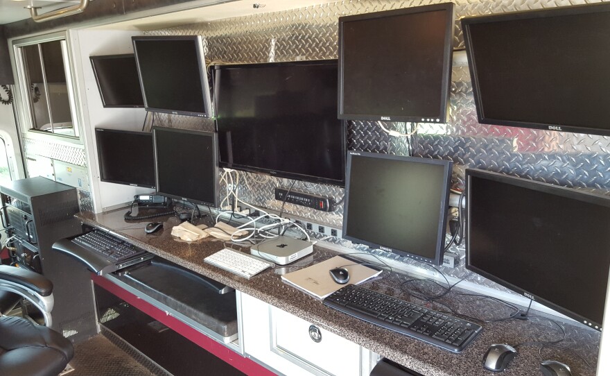
And then there's the big guns. A massive truck at UAH carries the Mobile Alabama X-Band radar system – MAX for short. The dual-polarization radar will allow the VORTEX team to get lots of detailed information as storms pass by: things like rain intensity, wind speed, and even rotation that could suggest tornadoes are forming.
While I heard about all the bells and whistles, Rasmussen and other administrators were hard at work planning tomorrow’s deployment. They held meetings most of the evening hammering out the final details of exactly where to be and when.
“Starting at about 4:00 tomorrow morning, teams will begin collecting soundings, where they measure the wind, temperature, humidity up through the atmosphere all over this part of Alabama. And then at about 7 a.m., the mobile Dopplers and all the other instruments will start taking observations.”
Dark and early the next morning, the teams headed out to rural spots across north Alabama to gather data that they hope will lead to a much better understanding of Southeastern storms. But Rasmussen says no matter how much of the science they understand, there’s another factor at play.
“Even if we scientists learn enough that the weather service can make perfect forecasts – you know, they can say down to the city block an hour in advance where a tornado is going to be and how strong it’ll be – suppose somewhere in the future they can do that. That really does people no good if they don’t receive the information, or if they don’t know how to interpret it, or if they don’t know how to react to it, or if they don’t have shelter.”

One of the main reasons the VORTEX-SE study got funded is the extremely high number of tornado-related fatalities that occur in the Southeast. Even though the majority of tornadoes occur on the Great Plains, the vast majority of tornado deaths are concentrated in the Southeast.
Why is this happening? Researchers have identified some likely culprits. One is population density.
“In Alabama, people live on every dirt road. There’s always a church. You’re going to have someone be impacted by almost every tornado in the Southeast, and that’s a big difference between here and the Plains.”
That’s Kevin Laws, Science and Operations Officer at the National Weather Service in Birmingham. Another issue, according to Dr. Laura Myers with the University of Alabama’s Center for Advanced Public Safety, is the infrastructure in this area.
“We have a lot of manufactured homes, mobile homes, so there’s a lot of vulnerability, and so you’re going to have more fatalities with poor infrastructure.”
Another problem is terrain. Trees and other obstructions don’t just block radar from seeing storms, they keep the people in the path of that storm in the dark as well.
“…and so they may waste their lead time trying to figure out if it’s really coming, and it may be too late, because we can’t see them coming.”
But by far the biggest factor according to the researchers is when tornadoes here usually occur.
“Typically out in the Midwest, those storms will fire in the late afternoon hours and the evening hours, and what happens after they fire in the Midwest is they’ll come into the Southeast during the nighttime hours, and it’s far more challenging for folks to respond to severe weather at night.”
John De Block is the Warning Coordination Meteorologist at NWS Birmingham.
Kevin Laws knows full well how dangerous nighttime tornadoes can be.
“January 23, 2012, we had a major supercell come through Jefferson County. This was 3 o’clock in the morning. A very high-end damaging EF-3 tornado was wiping homes off their foundations at 3 a.m. Think about that. So you’re dead asleep. It’s hard enough to get up at 3 a.m. What is going to wake you up? What is that process that that person goes through at 3 a.m. to get that message and get to safety?”
Laura Myers says it’s a challenge to get that warning out.
“In the south, people tend to rely on traditional systems, so a lot of people rely on sirens – community sirens – and at night, inside your home, you’re not going to hear those sirens. So we want to understand how well that’s working for people at night, how confident people feel at night going to bed if there’s an event transpiring in the region, how do they deal with that and do they feel prepared to get the information as well as take action during the night.”
That’s a major part of her research in VORTEX-SE: What can meteorologists do to make sure that warning makes it to the people that will be affected? The National Weather Service says the first step is making sure the warnings they issue are as accurate as they can be. Here’s John De Block again.
“Right now, I think the best thing we can try to do is to understand the tornadogenesis in the Southeast as best we can, and to become better meteorologists. We need to practice what we do more often, and use those lessons learned for the next threat that comes along.”
But no matter how good the forecasting becomes, even Dr. Myers doubts they’ll get to everyone.
“There’s always a percentage of the population who does get tired of it, and they get more fatigued. But that’s going to be the case with almost any type of warning. We can have very active tornado warnings with confirmed tornadoes, and the public will get upset that we’ve gone to wall-to-wall coverage, we’re interrupting Dancing with the Stars, they don’t want to know about it. And that’s going to hold true across the board, and we can’t change the minds of those people.”
Five years out from April 27, 2011, that doesn’t seem to be a problem in Tuscaloosa.

ABC 33/40 in Birmingham sent their weather team to Tuscaloosa earlier this month for a citizen storm spotter training class. In a huge riverfront building, the class was standing room only.
“Today, I mean, you see – not even an open seat, so that’s awesome to see. And also it says a lot about Tuscaloosa.”
ABC 33/40 weekend meteorologist Meaghan Thomas was a student at the University of Alabama on April 27, 2011. She saw firsthand how important a basic understanding of severe weather can be.
“Like, a lot of my sorority sisters, they didn’t really understand weather. Everyone was panicking. Everyone didn’t know what they were looking at, or know how to be safe. And I’ve always said, ‘If you know how something forms and what to look for, you’ll be safer.’”
But the severe weather training these classes offer isn’t just for the students’ safety. It’s to help the meteorologists as well.
“Instead of sending us a message that says ‘Hey, that’s a really ugly-looking cloud outside’, you could say ‘Hey, that’s a cumulonimbus cloud, that’s a wall cloud, that’s a funnel cloud’ – you’ll be able to distinguish between all of those things, which gives us a better idea of what you’re seeing, what can we tell the public.”
An informed and weather-aware public helps TV meteorologists do their jobs better, but they still rely on the National Weather Service for the best and latest data. And those meteorologists are hopeful that VORTEX will help them make their best even better. Here’s John De Block:
“We’re hoping that with VORTEX, they’ll get into the nitty gritty details of the data, and indeed confirm, perhaps, some of the things that we’ve confirmed here locally. That will enable some of the other offices in the Southeast, hopefully, to pick up on those clues about the difference in the storms from the Midwest to the Southeast, and issue better warnings for the folks in the Southeast.”
The next step is making sure the public is equipped and informed enough to react to those warnings. Based on the turnout in Tuscaloosa, it looks like we’re off to a good start.


